Weather warning increased to amber ahead of Storm Éowyn

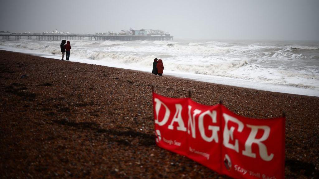
Coastal areas will be particularly dangerous during Storm Éowyn
-
Published
Amber severe weather warnings from the Met Office have been issued for Friday as Storm Éowyn brings severe gales.
The strongest winds are likely around Irish Sea coasts where gusts could be in excess of 90mph (145km/h).
But gusts of 60-70mph (97-113km/h) are widely expected throughout the day with yellow weather warnings issued from Thursday.
Heavy rain and hill snow will also spread eastwards across the United Kingdom.
Met Office yellow and amber severe weather warnings for Friday
Storm Éowyn – pronounced “ay-oh-win” – and the fifth named storm of the season will undergo rapid development during Thursday as it moves across the Atlantic. It will be fuelled by a very powerful jet stream which is fast moving air high in the atmosphere where wind speeds are around 260mph (418km/h).
The exact track that Éowyn takes as it approaches the UK and Ireland will determine where the strongest winds will be.
It’ll turn windy on Thursday, especially on coasts of west Wales and southern England where there is a yellow Met Office wind warning in force from 07:00 GMT to 18:00.
However, this spell of strong winds with gusts of 50-60mph (80-97km/h) is not connected to Storm Éowyn.
The strong winds associated with Éoywn will start on Friday morning.
Met Office amber severe weather warning covers Northern Ireland, southern Scotland, northern England and North Wales from 06:00 GMT to 21:00 on Friday.
Wind gusts of 60-70mph (97-113km/h) fairly widely inland and 80-90mph (129-145km/h) along more exposed coasts and hills.
The Met Office suggest that we could even perhaps see even higher gusts in a few locations.
Elsewhere, yellow warnings have been issued for most of the UK on Friday and continuing across much of Scotland into Saturday.
Across northern and western Scotland, parts of the Midlands and southern England, gusts of 50-65mph (80-105km/h) are expected but around coastal areas gusts up to 80mph (129km/h) are likely.
Met Office warnings could still be adjusted and possibly upgraded ahead of Friday.
These gales and severe gales are likely to bring travel disruption and some damage, which could include roof tiles being blown off and power cuts.
Large waves are also expected with coastal overtopping.
Heavy rain is also expected where there is a yellow Met Office rain warning for west Wales and south-west England from midnight to 09:00 GMT Friday.
While it will turn milder for some, especially in the south, it will remain cold enough for snow to fall over hills in Scotland and northern England.
With potentially 15-25cm (6-10 in) of snow to fall over the highest ground there is a separate yellow warning for snow from 03:00 GMT to 12:00 on Friday.
Storm Éowyn will move in across the UK and Ireland on Friday
Storm Éowyn is likely to be an exceptional storm for the Republic of Ireland too.
A red warning – the most severe – has been issued by Met Éireann for Clare, Cork, Kerry and Limerick on Friday with gusts in excess of 80mph (130km/h).
Elsewhere across the country, there is an amber weather warning also in force.
The forecaster says that “westerly, severe, damaging and destructive winds with gusts of 81mph (130km/h) will be felt widely.”
Impacts will include fallen trees, structural damage, power cuts and disruption with cancellation of transport services.
On the west coast of Ireland, weather forecast models are even suggesting wind gusts of 100-120mph (161-193km/h) throughout Friday.
These wind speeds could be the strongest experienced here since Storm Debbie in 1961 when a gust of 113mph (182km/h) was recorded at Malin Head.
-
-
Published1 day ago
-
-
-
Published21 November 2024
-
-
-
Published5 December 2024
-


