


Arctic air brings freeze to UK as weather warning issued

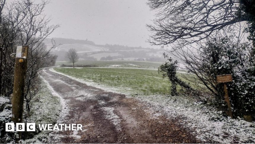
Wintry showers brought a dusting of snow to higher ground in parts of western England on Wednesday including Brookthorpe in Gloucestershire
-
Published
The recent spring warmth we saw during the weekend has been replaced by a colder weather pattern, with northerly winds bringing chilly air all the way from the Arctic.
On Wednesday, snow showers fell in several places including the Southern Uplands, the Shropshire Hills and the Cotswolds. There was even a brief spell of snow that affected racegoers at day 2 of the Cheltenham Festival.
Temperatures have already plummeted across the UK and are expected to remain below average for the rest of this week. Expect single digits by day, and a chance of overnight frosts.
The Met Office have issued a yellow warning for ice. It covers parts of northern England over Wednesday night into early Thursday morning, especially for the Pennines and Peak District.

Blue skies and sunshine were the order of the day in Chester on Sunday. The warmest spot was nearby Crosby in Merseyside that reach 19.7C
Sunday was the warmest day of the year so far in the UK with the temperature reaching 19.7C in Crosby, near Liverpool. But most of us had some warm spring sunshine with temperatures in the mid to high teens.
Temperatures were around 6 to 8 degrees above the March average and similar to what we would expect on a May day. However, some places have now seen a drop by about ten degrees since then hence the shock to our systems.

A cold airmass originating from the Arctic has swept across the UK
Big swings in spring
As we head toward the spring equinox on 20 March, daylight hours are rapidly increasing and we are feeling more strength from the Sun.
Wind direction at this time of year is really influential to our weather. At the beginning of March, southerly winds brought warmer air up from the tropics to bring above average temperatures across the UK. With a switch in wind direction to a northerly this week, the – still very cold – Arctic winds will bring temperatures below average.
For the remainder of this week, all of the UK will feel the cold with maximums of 5 to 9C. For some context, the average mid-March daytime maximum temperatures are around 7 to 11C.
Temperatures overnight will drop close to or just below freezing for many of us. A brisk north to north-easterly wind into Thursday will also make it feel colder than the thermometer suggests.
Despite the cold, there should be a lot of dry weather, with some spells of sunshine. There is also a chance of further wintry flurries for some, especially in parts of Scotland and north-east England.
-
-
Published20 November 2024
-
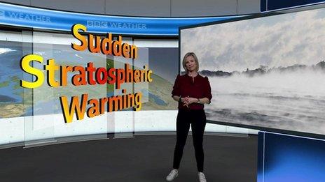
What’s causing the cold weather?
You may have heard talk of something called ‘sudden stratospheric warming‘ or SSW and its link with cold weather in the UK.
The colder weather this week is purely down to the change in wind direction to a northerly bringing the colder air from the Arctic, but it is possible that what’s going on in the stratosphere (around six miles above our heads) may have some impact on our weather later in the month.
Over the last few days observations have shown an ‘SSW event’ where the temperature at six miles high in the atmosphere has warmed from -75C to -30C. This sudden warming high in the atmosphere can potentially lead to much colder weather in the UK a few weeks after it happens; but not always.
We are therefore keeping a close eye on the forecast for the end of March to see how this event will affect our weather.
For the shorter term however, it will remain chilly for the rest of this week before temperatures return to more typical for mid-March into next week.
-
-
Published10 February 2023
-